This report is on a two-week canoe trip on Yellowstone Lake with my daughter, Katie, that began on 7/28/19 and ended on 8/10/19. The paddle trip started at the boat dock at Grant Village and ended on the sunny beach of Sedge Bay two weeks later, where my wife generously agreed to come pick us up.
The two-week trip consisted of ten paddle days along with five-day hikes. Originally, I had requested campsites, and number of nights at the same campsite, that would accommodate the day hikes, so that we wouldn’t have to paddle and do a day hike all in the same day. Unfortunately, on our second day, we had to do both. It was no big deal, but certainly wasn’t optimal from my perspective.
Another issue that arose when I received the unofficial permit, was that I didn’t get all the campsites along the lake that I requested. I had originally spaced the campsites out fairly evenly in terms of mileage, so that we would be paddling seven to eight miles a day. Unfortunately, again, since the Park Service didn’t grant our original request for campsites, we had a few longer paddle days and a few really short ones.
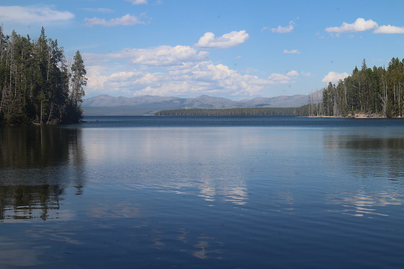
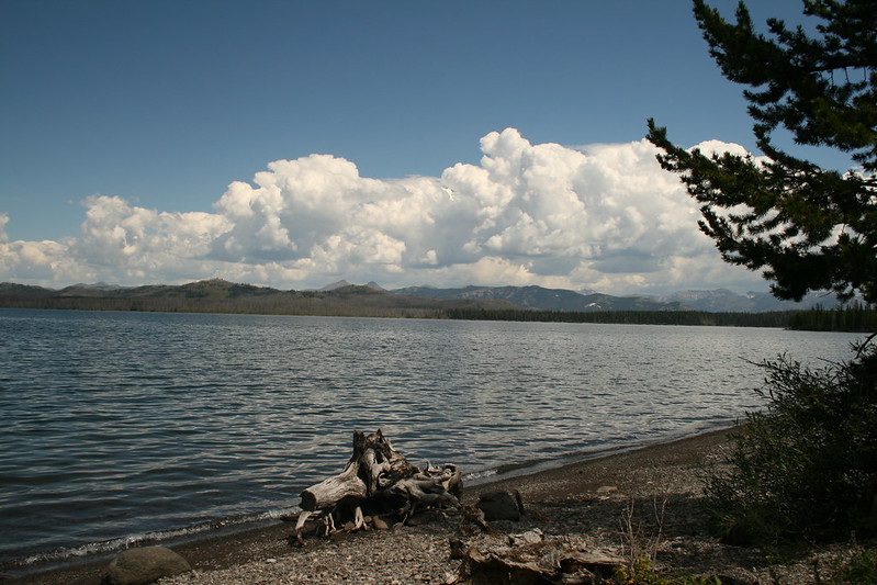
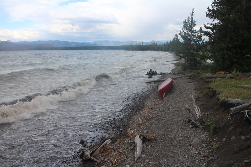
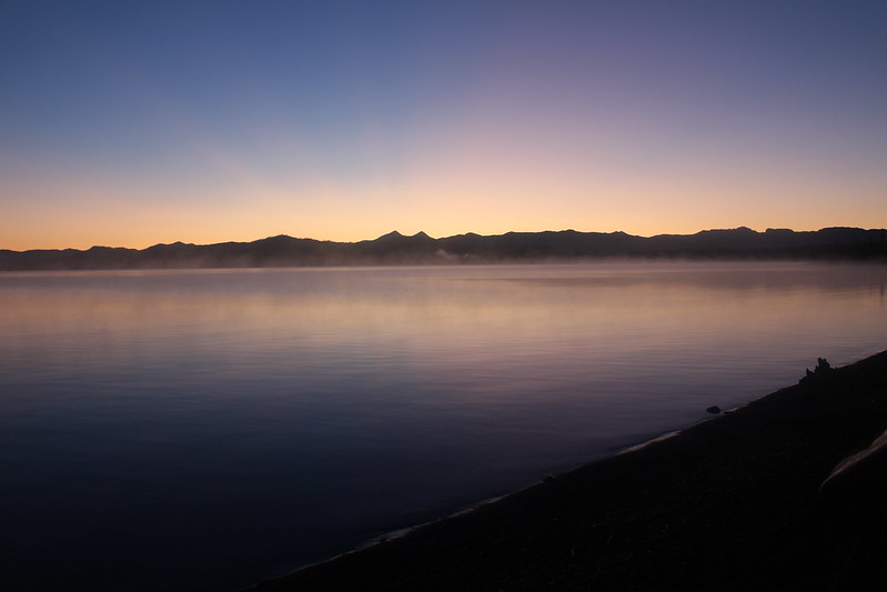
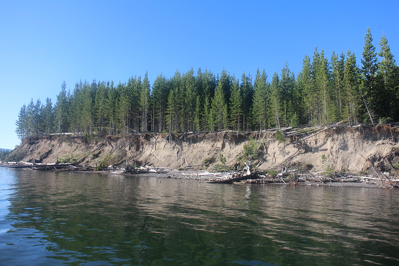
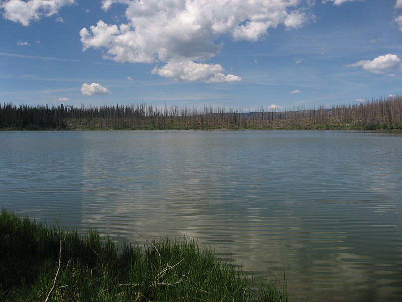
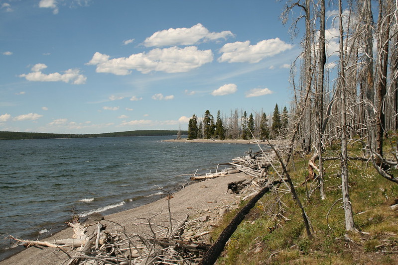
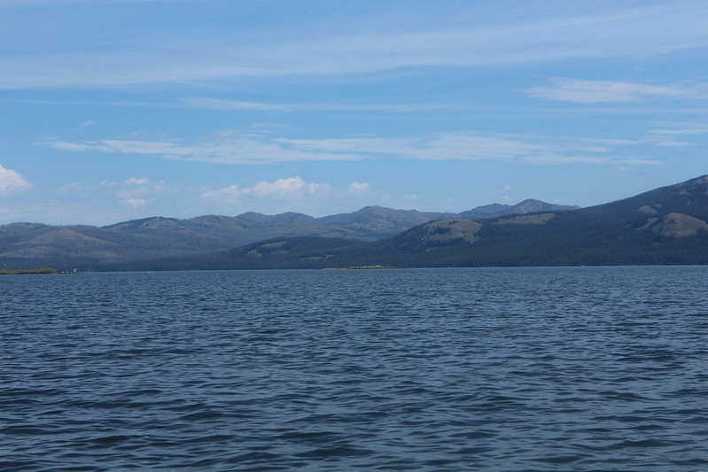
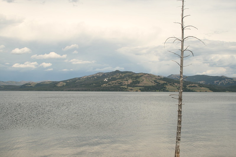
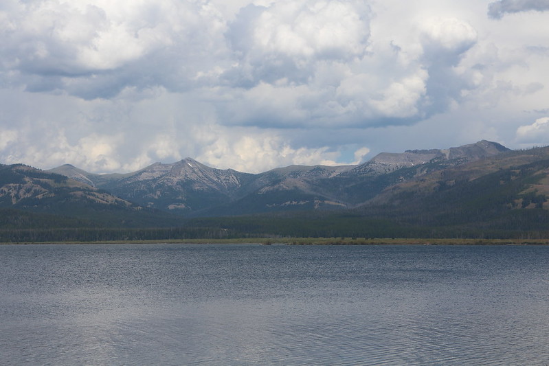
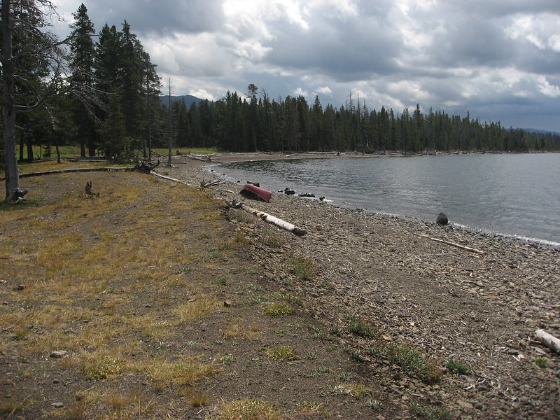
And now, a bit about the lake: The NPS website says that Yellowstone Lake at 7,733 feet is the largest, high elevation lake in North America. The lake is approximately 20 miles long and 14 miles wide with 141 miles of shoreline. Water temperature of the lake averages around 41°F, so swimming is not recommended. According to the NPS, Yellowstone Lake also holds the largest population of wild cutthroat trout, though the illegal introduction of non-native lake trout is threatening that population. My thoughts on the lake were that it seemed and acted like a large lake. Normally, the lake is relatively calm in the morning hours, with increasing choppiness as one heads into late morning and early afternoon. Later in the afternoon, the lake would see its first whitecaps and would stay agitated until seven or eight in the evening. Of course some days didn’t follow this pattern at all. On one day, the lake remained relatively calm all day while another was very choppy from the get go. But generally speaking, morning is when you wanted to be paddling. Also of note, the lake can change conditions very quickly – from calm to choppy to whitecaps in what seemed like a heartbeat. Due to the potential sudden changes in conditions, we tended to paddle close to the shoreline in case we needed to beach the canoe at a moment’s notice. The Yellowstone Lake’s shoreline varied along our route, from nice sandy beaches to rocky ones. At times, there were long stretches of cliffs, narrow beaches with downfall and driftwood that would keep one from landing there if lake conditions turned rough.
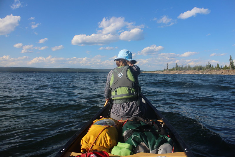
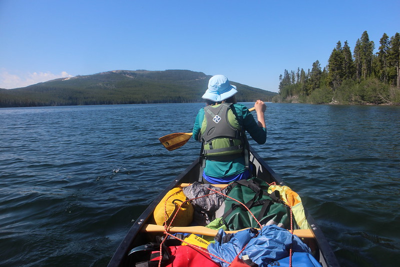
Now some thoughts on this write-up: This will be a long report. I decided to write just one trip report, broken up into days. I took over 1800 pictures on this trip, and going through them all and deciding what to use in this report was time consuming. Also, I found that a majority of my shots from the canoe didn’t translate well to final images. The shots seemed more impressive while out on the lake than on my laptop screen for some reason. I didn’t take many pictures when the lake became choppy as I had to concentrate on paddling and coordinating Katie’s paddling with my own. So in this report, you’ll get quite a few shoreline shots and pictures of my daughter’s back since she was manning the front of the canoe the entire trip.
Well, I hope it doesn’t end up being too long for most of you and now let’s get this thing started.
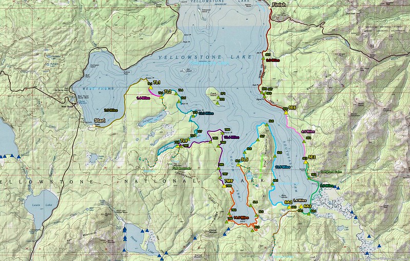
Map overview of our trip
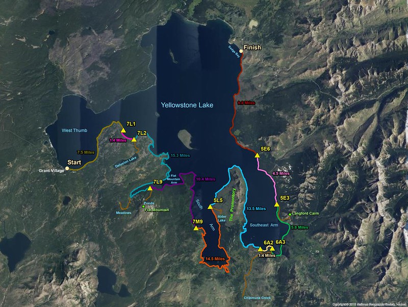
Imagery overview of our trip
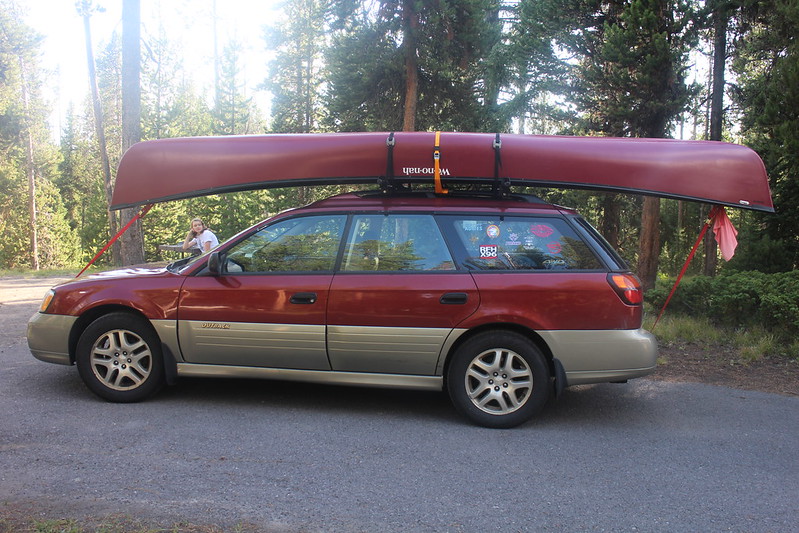
We stayed at the Grant Village Campground the night before we began our trip
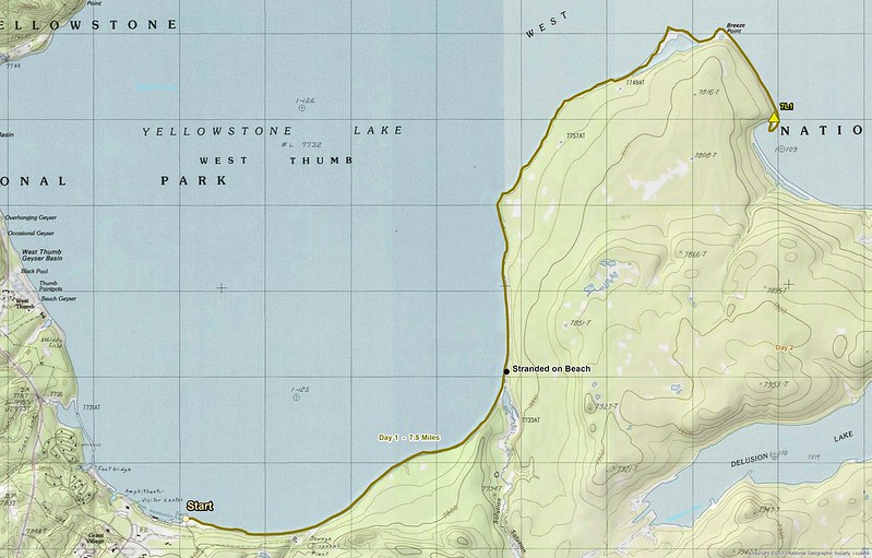
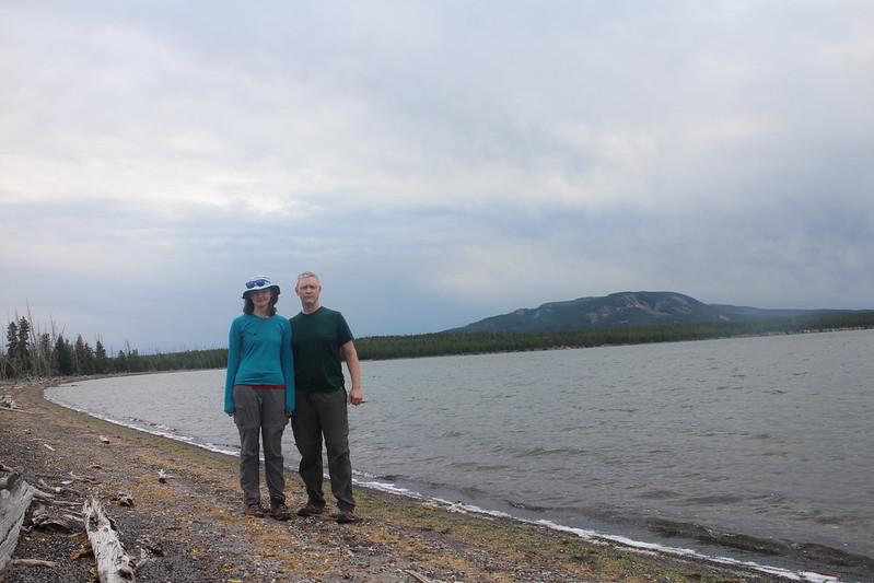
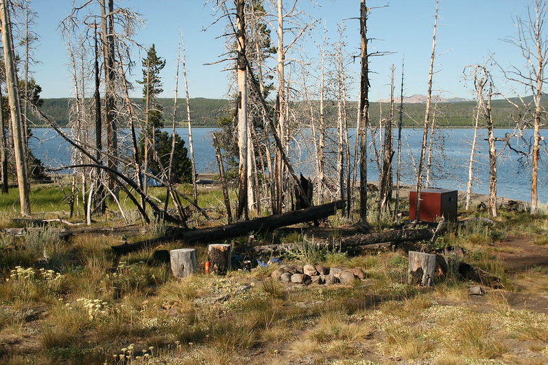
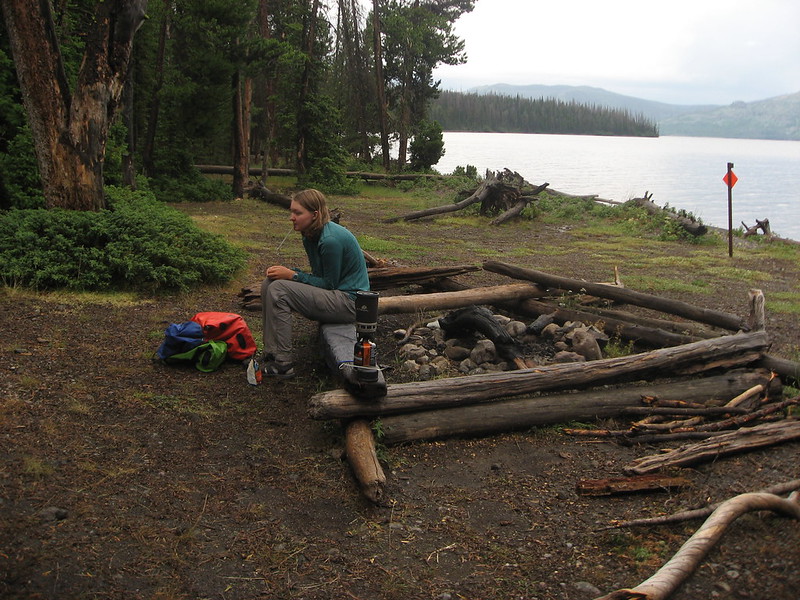
Day 1 - West Thumb Boat Dock to campsite 7L1 (7.5 miles) - We stayed at Grant Village Campground our first night in the Park and I had brought a second tent to use just for car camping so that I wouldn’t have to pack and unpack our dry bags that were heading into the backcountry with us. This turned out to be a mistake as it poured rain on us through the night and the tent was soaking wet come morning time. We then had to take the time to dry the tent off since it was going to be put back in my car for the two weeks while we were on the lake. This caused us to get a later start than what we had originally hoped for. After driving down to the boat docks, unloading the canoe and our gear, we finally set off at 10:00 am. The lake was already a wee bit choppy when we pushed off, but the conditions remained manageable for the first hour. After that, the lake gradually grew rougher, the wind picked way up and eventually we had to beach the canoe and wait for calmer conditions to prevail. So we ended up landing just north of the Solution Creek outlet and waited seven hours for the lake to reach a state where we felt comfortable paddling again. This occurred just after 6:30 in the evening, and we were back paddling towards campsite 7L1. We arrived at camp, just before eight o’clock and were pleasantly surprised to have seven deer (including two fawns) keep us company as we unloaded the canoe and set up camp. As the sun set and we retired to our tent, we heard an elk bugle off in the direction of our next night’s campsite. We ended up hearing elk bugling everyday of our trip. It was good to be back in Yellowstone.
Day 1 overview

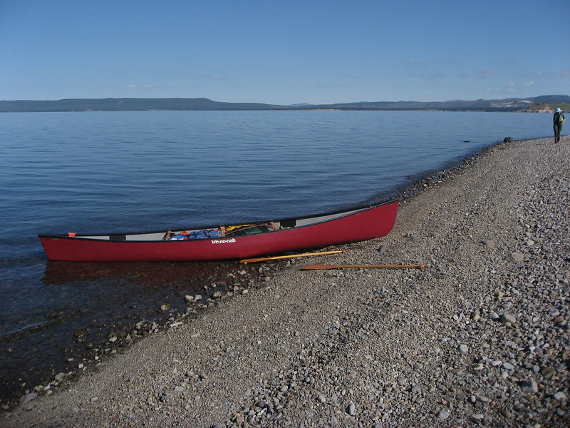
Ready to shove off at the Grant Village boat docks

Paddling on West Thumb

The Solution Creek outlet on the southern end of West Thumb
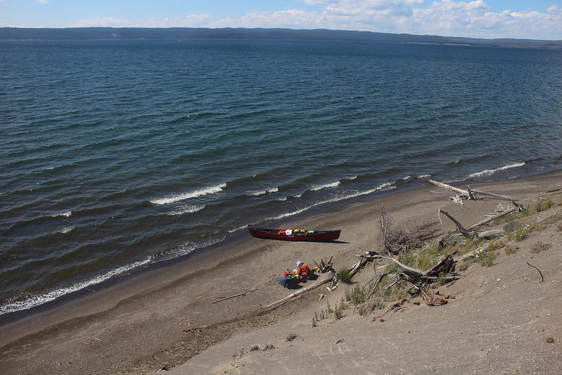
Stranded on the beach until the lake calms down
Back on the lake, paddling towards campsite 7L1
View to the northeast across the lake

Arriving at campsite 7L1

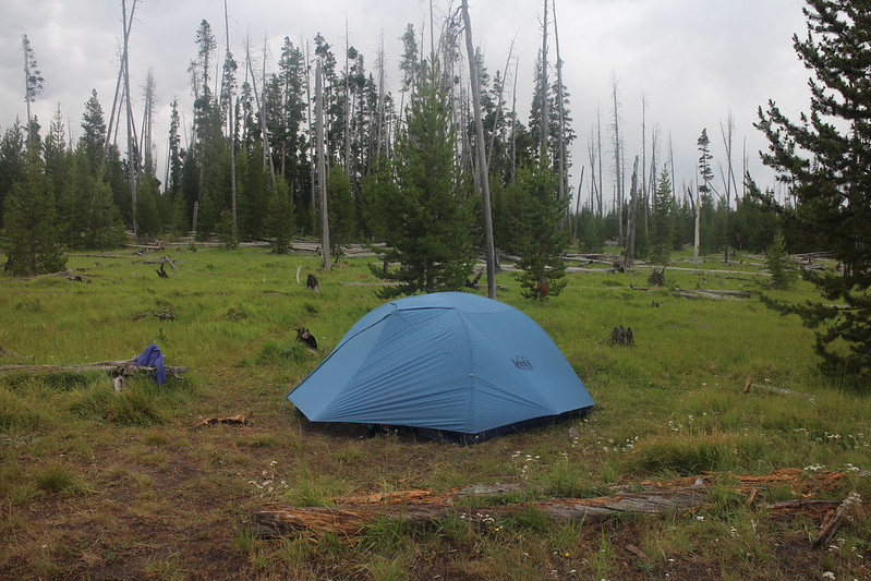
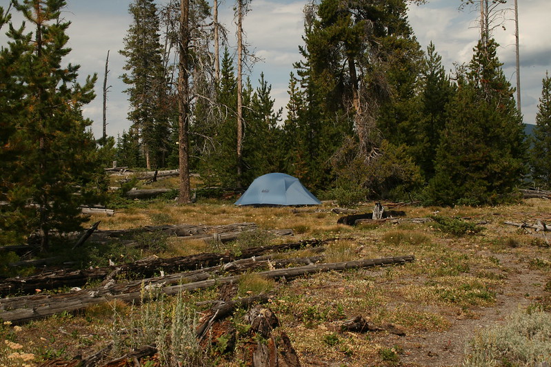
Our tent site at 7L1
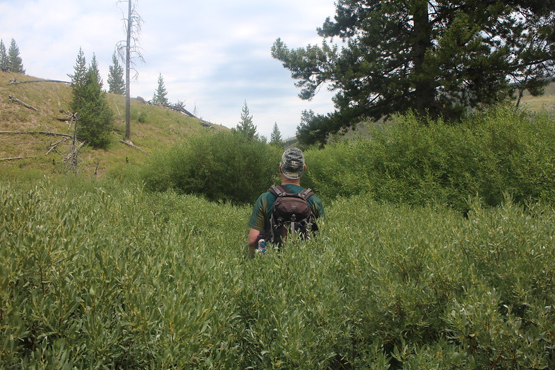
Day 2 - Campsite 7L1 to campsite 7L2 (1.4 miles) + Day Hike to Delusion Lake (3.0 miles RT) - Day two turned out to be one of our extremely short days on the paddle side of things, but that left us time to complete a day hike to the east shore of Delusion Lake. We made quick work of paddling to campsite 7L2, and after setting up camp we headed off to Delusion Lake. I’d hiked to west end of Delusion Lake back in 2015, but this time I wanted to visit the eastern shore of the lake to see what it was like. The route to Delusion was through old burn so it was slow going at times with a lot of downfall to negotiate. On our way to the lake, we ran into two elk who had to have been wondering what we were doing back in there. Once at the lake, we had excellent views of Flat Mountain and Mount Sheridan to the south and southeast. We proceeded to eat our lunch and enjoy the view before heading back to camp. We got back to our tent just in time as it began to rain. This campsite was another good place for deer to graze and we saw four of them (two of which were fawns).

day 2 overview
Packed up and ready to go
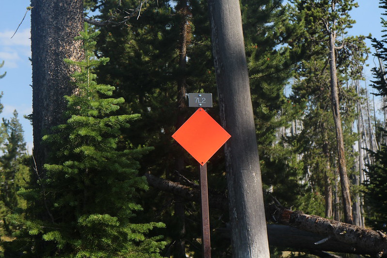
Campsite 7L2
Tent site at 7L2
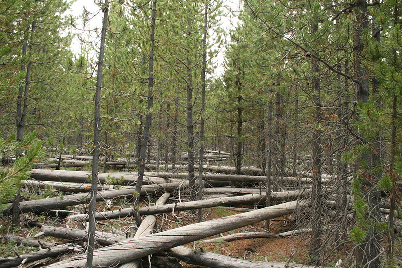
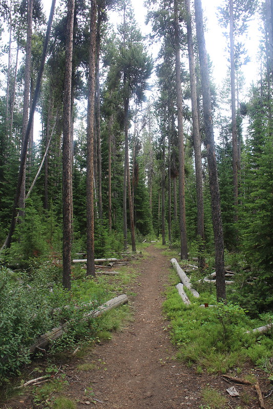
Typical of the route to Delusion Lake

Eastern shore of Delusion Lake
Mount Sheridan, viewed from Delusion Lake

Flat Mountain, viewed from Delusion Lake
At Delusion Lake

Back at camp
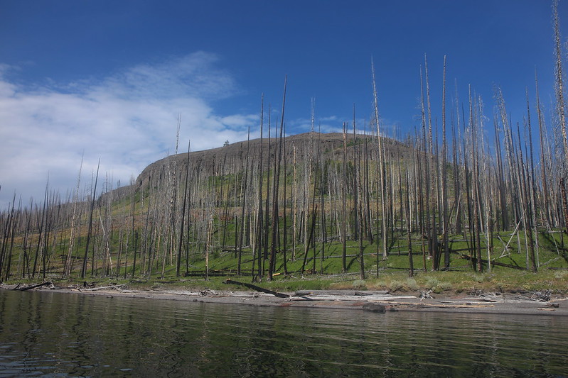
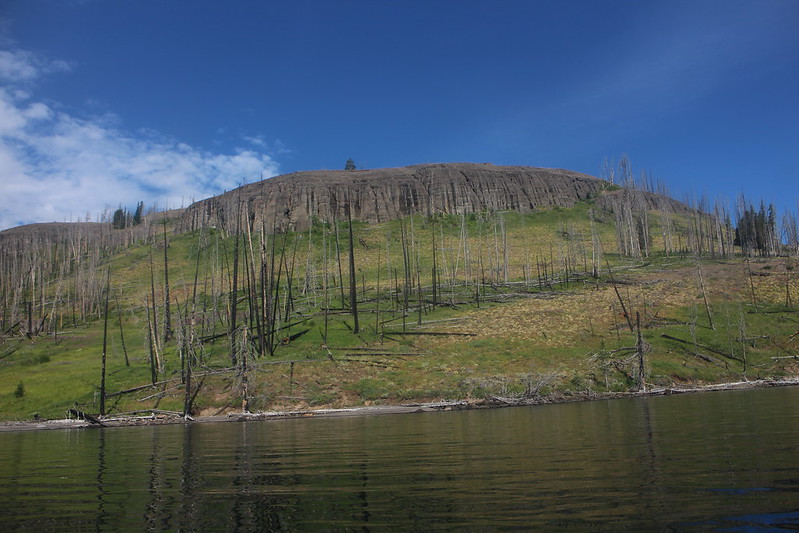
Day 3 - Campsite 7L2 to campsite 7L9 (15.3 miles) - Before our trip started, I knew this would be one of our most challenging paddle days. Not only was the mileage the most we would encounter on our trip, but the waves and wind would be working against us too. Campsite 7L9 is located on the south shore of Flat Mountain Arm and we would have to paddle down the entire length of the northern shore of the arm and then head back east along the southern shore to our campsite. The lake was just too unpredictable on this day to paddle straight across the arm to reach our camp. While we saw at least one Bald Eagle on every day we paddled, this day was our most productive as we spotted seven of them in trees or shrubs along the shore.

Day 3 overview

Deer, keeping us company for breakfast at campsite 7L2

Taking a break at campsite 7L6 with Flat Mountain in the distance

Eagle Bay
Entering Flat Mountain Arm
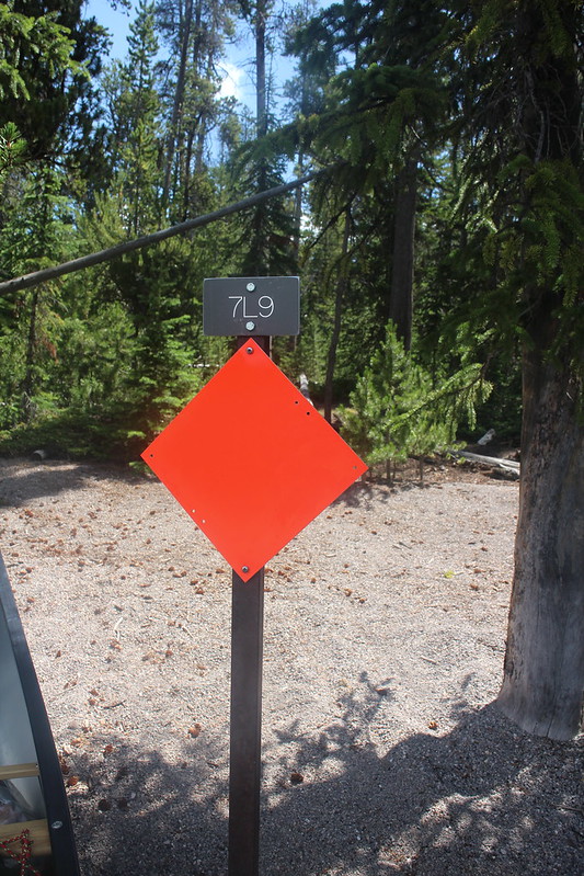
Arriving at campsite 7L9
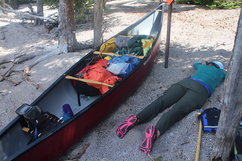
Worn out after the 15 mile paddle
Bear pole at campsite 7L9
A look east up Flat Mountain Arm
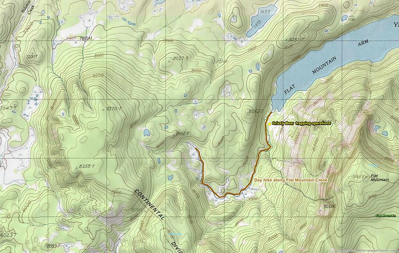
Day 4 – Day Hike along Flat Mountain Arm Creek (6 miles RT) - This day hike required a two mile paddle back west along the southern shore of Flat Mountain Arm to the meadows along Flat Mountain Arm Creek. Once we began our hike, we ran into signs that were posted that warned us that the Interagency Grizzly Bear Team were trapping Grizzly Bears in the area and to be sure and obey all closure and warning signs. We eventually ran into the closure signs and could make out a culvert trap up in the trees.
After leaving the closure signs, we continued along the creek and through the meadows. We encountered many marshy areas along our route and wet feet were the norm for the day. The wildflowers were in full bloom through the meadows and we stopped and had lunch amongst them. After lunch, we continued on until we reached the end of the meadows, where we turned around and headed back the way we had come. Once we reached the canoe, we paddled back to camp for dinner. At night, we heard wolves howling which we thoroughly enjoyed.
Day 4 overview
At the west end of Flat Mountain Arm
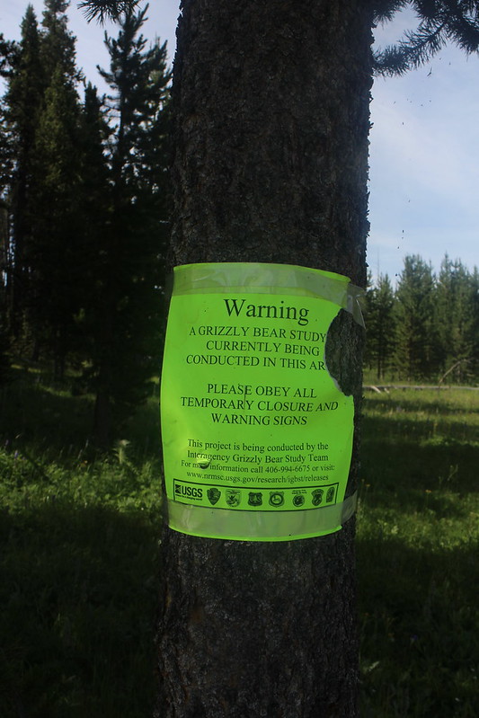
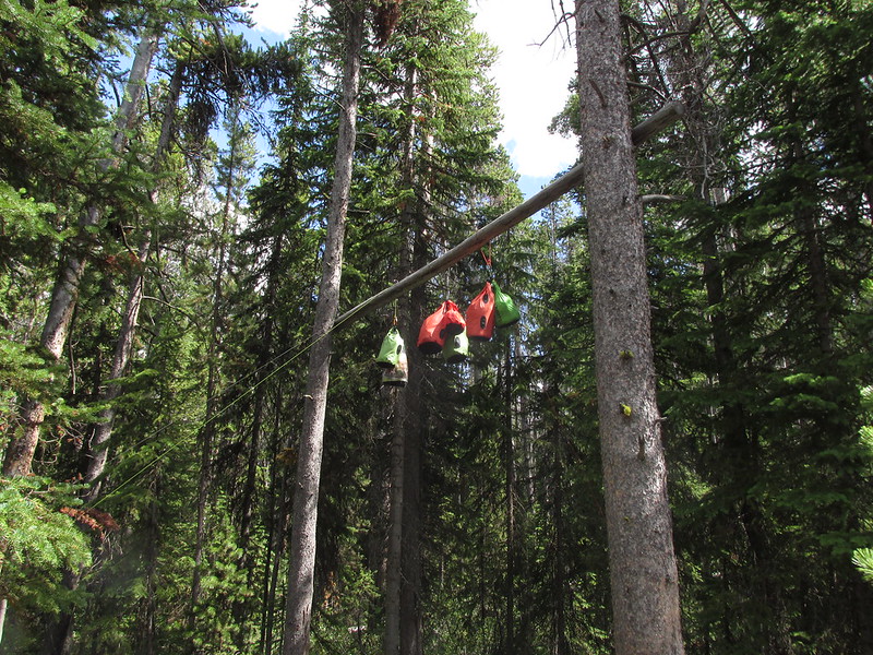
Warning of Grizzly Bear trapping operations

Grizzly Bear trapping operations sign
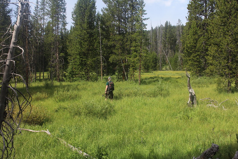
Hiking through the meadows along Flat Mountain Arm Creek
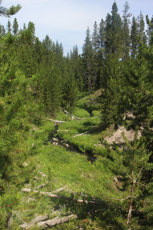
Flat Mountain Creek

Meadows along Flat Mountain Creek

Looking back east at the west side of Flat Mountain

Meadows along Flat Mountain Creek

Back at the canoe, ready to paddle back to camp
Day 5 - Campsite 7L9 to campsite 7M9 (10.4 miles) - Not too bad of a paddle day on day five. remained calm up until about two o’clock in the afternoon and we made good time as we left Flat Mountain Arm and turned down into the South Arm of Yellowstone Lake.
Around 2:00 pm the wind picked up and the lake became extremely rough with some three-foot waves washing against the shore. I was glad we didn’t have to deal with it and hoped it would calm down by the next morning.
Periodically throughout the day we could hear the prehistoric calls of Sandhill Cranes, that sounded as if they were reasonably close, though we could never see them.

Day 5 overview
Calm waters on Flat Mountain arm on our fifth morning

Taking a break at campsite 7M4, after turning south into the South Arm of Yellowstone Lake

Looking south into the South Arm of Yellowstone Lake

One of many Bald Eagles we passed on our trip
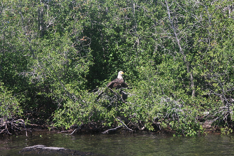
Another Bald Eagle

Enjoying a nice paddle day

Arriving at campsite 7M9
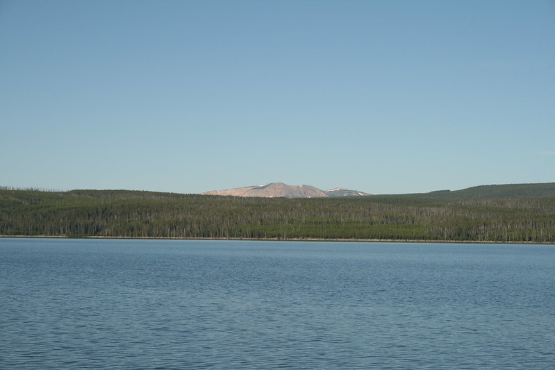
View across the South Arm towards The Promontory

View towards Mount Schurz
Agitated lake. I hope it calms down before morning.
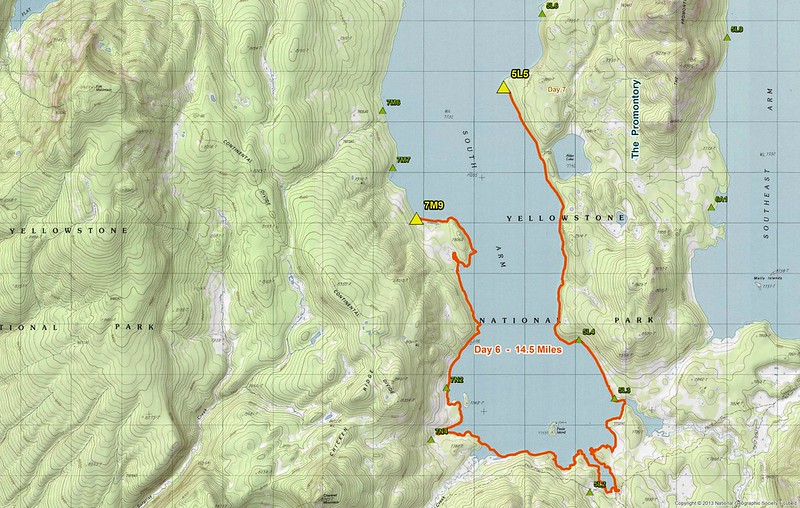
Day 6 - Campsite 7M9 to campsite 5L5 (14.5 miles) - Another worrisome day for me as we had two long paddle days back-to-back (our only one of the trip) and I wasn’t sure if Katie would hold out, but it turned out that I was worried for nothing as she did splendidly. Day’s six paddle would take us to the southern end of the South Arm and past Pearle Island which has a patrol cabin located on it. We’d then turn north along the Promontory until we reached camp. We paddled by many loons on this day and they let us know of their displeasure of us as we passed by them.
Since the Promontory burned a few years back, the Park Service has installed bear boxes at the affected campsites since the bear poles had burned up.
As we arrived at our campsite, we quickly noticed that there were only two trees that offered us shade or any kind of relief from the sun. So, we ended up setting up our tent by one and we used the other to shade our lounge chairs throughout the day.
Day 6 overview
Just before sunrise on the South Arm
Steep shoreline to start off the day

Approaching the bottom of the South Arm of Yellowstone Lake
Peale Island and patrol cabin

Taking a break at campsite 5L3 before making our way up the west side of The Promontory

Two loons keeping us company
Campsite 5L5 signpost

Tent site at 5L5
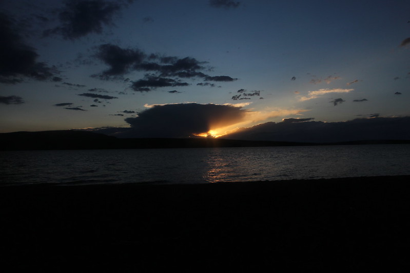
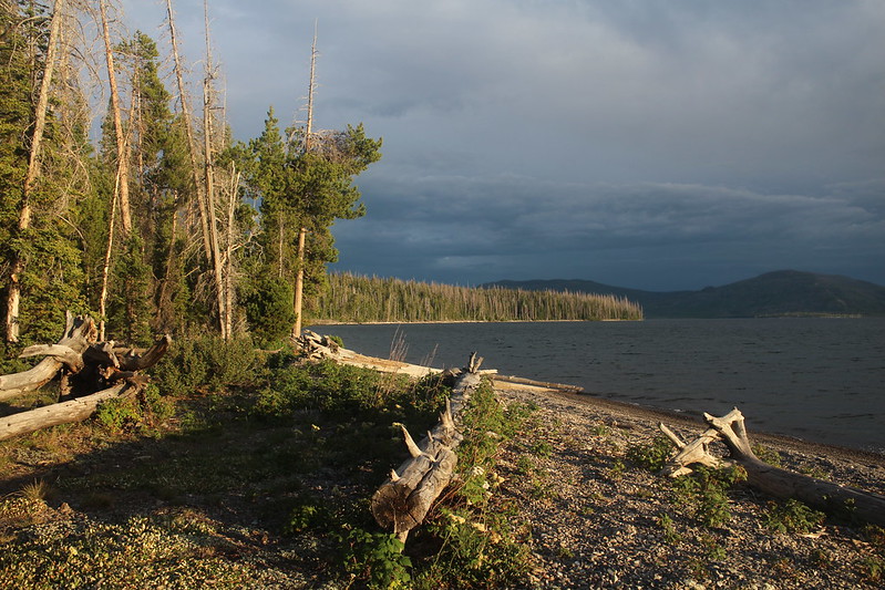
Sunset at 5L5
Day 7 - Day Hike to Alder Lake (3.0 miles RT) - While today’s hike was short, it was difficult. Off-trailing through what I was now referring to as “The Ghost Forest”, the hike started out rather nicely, but quickly turned into extremely slow progress due to all the downfall. Eventually, we broke out of the trees into a small meadow with Alder Lake to the south of us. As we made our way to the lake, we disturbed a couple of Sandhill Cranes that took off as we approached.
On our way back from the lake, I decided to head to the outlet of Alder Lake instead of going back the way we had come. This turned out to be a mistake, and it took us twice as long to get back to camp and I was worn out when we arrived.
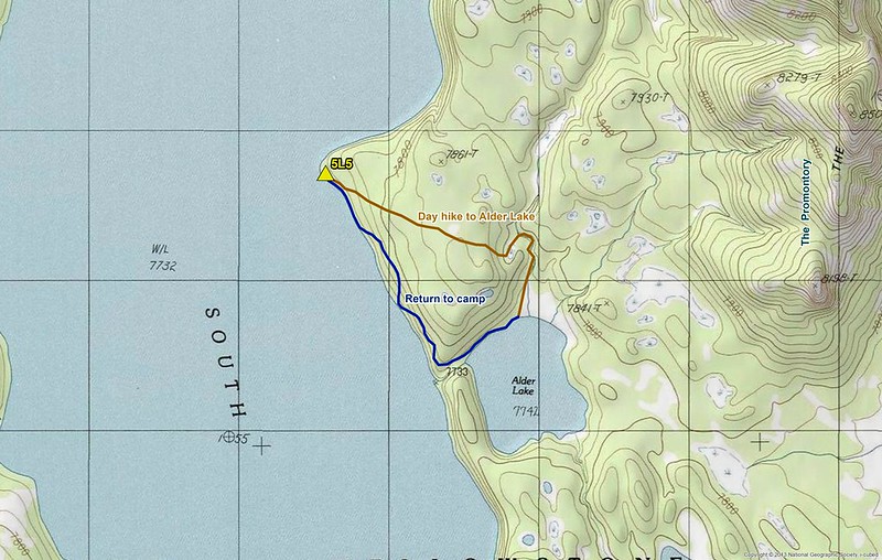
Day 7 overview
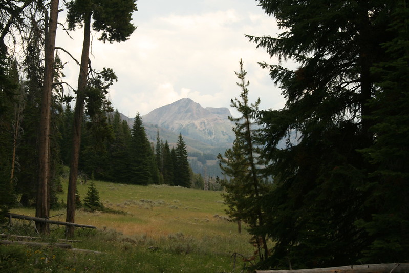
Mount Sheridan to the west
Flat Mountain to the west
Eating area and bear box at campsite 5L5

The Ghost Forest - the way to Alder Lake
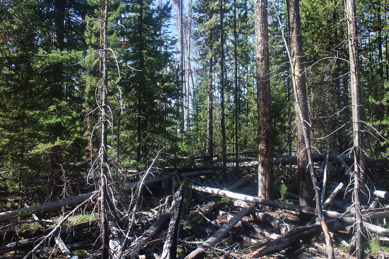
Rough going!

On our way to Alder Lake

Our first View of the lake

Alder Lake
Alder Lake

Wildflowers along the shore of the lake

The way back to camp. Aargh!
Camp is just around the distant bend.
Day 8 - Campsite 5L5 to campsite 6A2 (13.5 miles) - Day eight’s paddle would take us north along the west side of the Promontory, around the northern point of the Promontory, and then back down the east side on the Southeast Arm of Yellowstone Lake. Going around the northern point of the Promontory was tricky, but once past that all we had to deal with was a slight headwind. We paddled past Mollies Island in the southeast corner of the Southeast Arm where pelicans nest. After setting up camp at site 6A2, we hiked about .5 miles to the Trail Creek Trail and back.

Day 8 overview

Rounding The Promontory, heading into the Southeast Arm of Yellowstone Lake

Breaking at campsite 5L9
East side view of The Promontory - heading south down the Southeast Arm of Yellowstone Lake
Cliffs, along the east side of the Promontory
Difficult to make out, but in the distance is Molly Island with nesting Pelicans
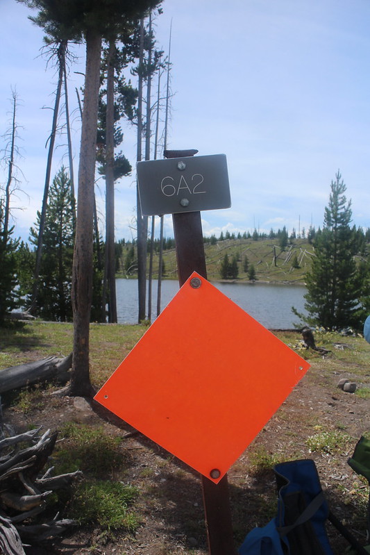
Made it to campsite 6A2
View across the Southeast Arm towards Langford Cairn

Always good to have one of these at a campsite

A short hike out to the Trail Creek Trail from campsite 6A2
Day 9 - Campsite 6A2 to campsite 6A3 (1.4 miles) - Having to go less than two miles today meant that we got to sleep in for a change. We had a nasty thunderstorm roll over us in the night. You know the kind where you see a flash and get an immediate boom. As I mentioned at the beginning of this report, I hadn’t requested 6A2 but it was what we ended up with which left us with the very short paddle to 6A3. It turned out that the long paddle the previous day worked in our favor. After finishing breakfast, we were taking down our tent about 10:30 in the morning, when we heard a big splash! Now 6A2 is located on a small peninsula between a cove to the south and Yellowstone Lake to the north. Many waterfowl (ducks, geese and pelicans) had been landing in the cove, so we had gotten use to hearing splashes as they touched down on the water. But this splash seemed larger. My daughter even said, “That sounded like a big splash!” I agreed with her and tried to peer around the trees between our tent and the food area to see if I could see the channel between the cove and the lake. I couldn’t quite see the channel from where I stood, so I started to go back to breaking our tent down. Well, about two seconds later a Grizzly Bear walked from a row of trees just to the west of us and walked right by us. Not fifteen feet to the north of us, it passed us and continued up the trail that leads to the pit toilet. It acted as if it didn’t know that we were there. It paid no attention to our presence. I was at once exhilarated and terrified at the same time. Neither my daughter or I even reached for our bear spray cans, which were located in our front pockets. You could clearly see the Grizzly’s claws and foot pads as he walked past us and on up the bluff towards the pit toilet. This was a good-looking bear too – dark, grizzled and wet. Apparently, it had been following the shoreline and swam the channel just before passing by us. I looked at Katie and said, “There is your bear, and a Grizzly to boot.” Katie had mentioned to me a week or two before we left on this trip that she had never seen a bear in the backcountry and I’ve been taking her into the Yellowstone backcountry since she was four years old. I told her how lucky she was that she got to observe a Grizzly Bear from such a close distance and that most people, even those in the backcountry never have the opportunity to see one, let alone up close and personal. Wow! What an experience. What a magnificent animal. I did notice as the bear went by, other than the splash when it entered the channel, is that it did not make a sound. If we had had our backs to it, we would have never known it was there. I found this to be a bit eerie and thought often about it for the rest of our trip.
Well, we were fired up for the rest of the day and the encounter was easily the highlight of our trip.
It took us about twenty minutes to paddle to 6A3, where there again were deer grazing just off the shore near the campsite sign. After going ashore and setting up our camp, we hiked down to the Trail Creek Patrol Cabin to see if a ranger was present. No one was there, but we returned after dinner and found the cabin occupied. We chatted with the ranger and told him about our Grizzly encounter from earlier in the morning. He told us that he was heading out of the backcountry the next day and wished us luck on the rest of our trip. We returned to camp, looking forward to our day hike along the Two Ocean Plateau Trail the next day.

Day 9 overview
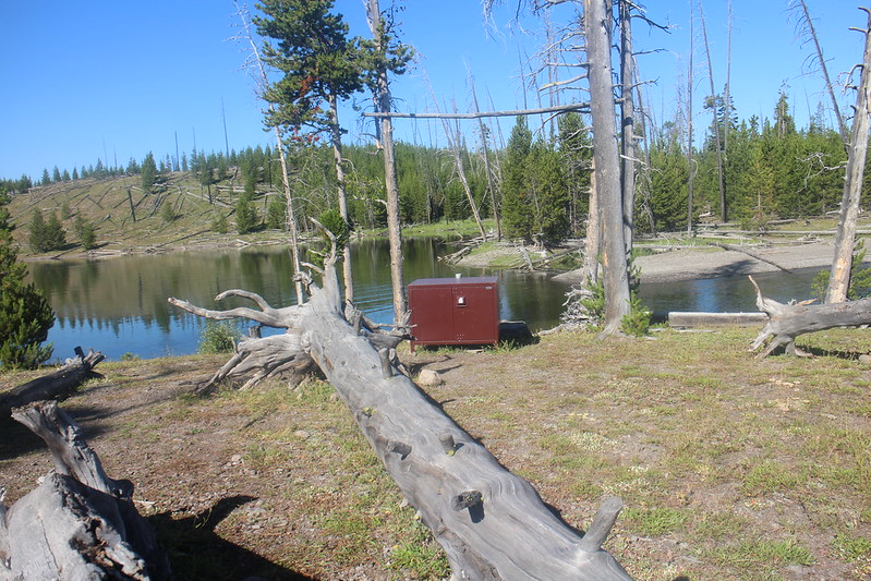
Bear box and bear pole at campsite 6A2
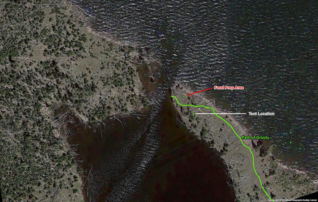
Path of Grizzly Bear through our campsite as we were taking down our tent

Path the grizzly toke through our campsite - I'm on the trail that leads to the pit toilet, looking back down towards our campsite

Ready for a short paddle to campsite 6A3

A deer awaiting our arrival at campsite 6A3

Campsite 6A3
A look across the southeast Arm towards the Beaverdam Creek Drainage and surrounding mountains
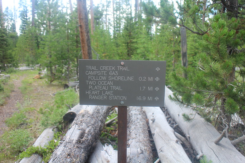
A mileage signpost that we ran into on our walk to the Trail Creek Patrol Cabin

Trail Creek Patrol Cabin
Day 10 - Day Hike along the Two Ocean Plateau Trail and Chipmunk Creek (11.2 miles RT) - The Two Ocean Plateau Trail is one of the few trails in Yellowstone that I have not hiked or backpacked on, so I was looking forward to this hike. Also, this would be my first long hike since my sports hernia surgery in June and I was looking forward to see how I held up, as this would be my warm up hike for the Mary Mountain Trail hike (20 miles) that we would be doing the day after our canoe trip.
We started off around nine in the morning on what turned out to be a very hot day – easily the hottest of the trip so far. We first had to make our way from our campsite to the Trail Creek Trail, the intersection of which is not far from the Trail Creek Patrol Cabin. We hiked west for approximately 1.5 miles until we reached the intersection with the Two Ocean Plateau Trail. The Two Ocean Plateau Trail essentially runs south, eventually hooking up with and following Chipmunk Creek. If you take the trail all the way south, you’ll end up at the South Boundary Trail. We found the trail difficult to follow at times as it made its way through willows. This trail heads through some wild country. It appeared to be excellent moose habitat, but we never saw one. We did see a few more deer though and we ran across some beaver dams on Chipmunk Creek. Speaking of Chipmunk Creek, on one of our crossings, I sat down to take my shoes off and ended up sitting in an ant’s nest. They swarmed quickly, biting as they went. One of the cons of wearing a kilt I guess. It was one of the more interesting creek crossing I’ve ever had to deal with. At roughly the 5.5 mile mark, we stopped and had lunch before retracing our steps back to camp.

Day 10 overview
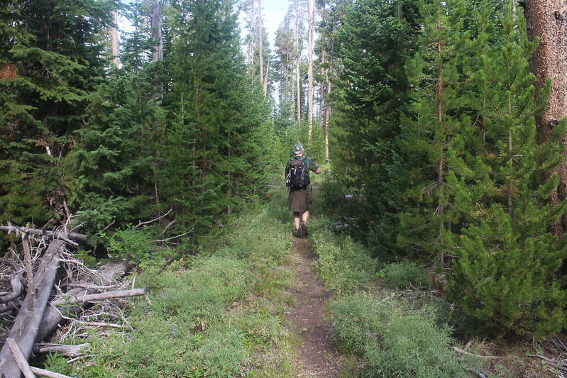
Hiking along the Trail Creek Trail

Pond full of Lily Pads on our way to the Two Ocean Plateau Trail

Trail junction signpost located at the junction of the Trail Creek Trail and two Ocean Plateau Trail

Lots oh hiking through the willows on this day hike

Chipmunk Creek

Beaver dam on Chipmunk Creek
Two Ocean Plateau country
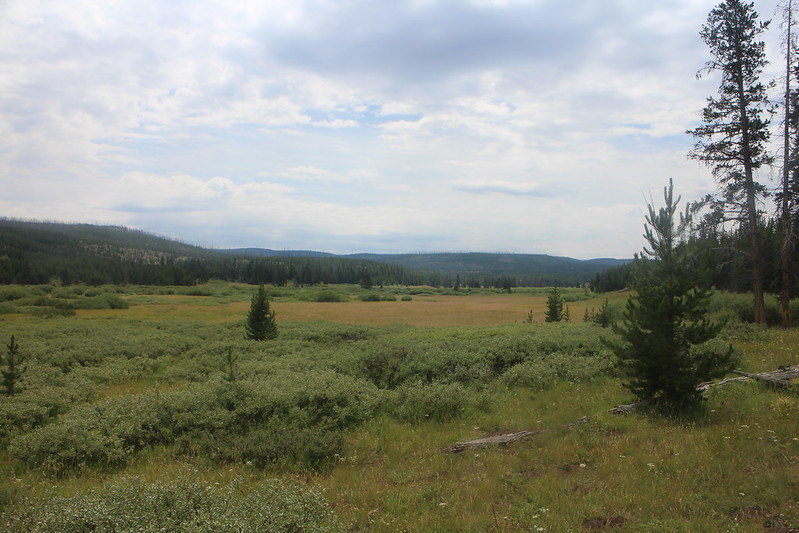
Two Ocean Plateau country
Hope this is the right way.

Grouse along the trail

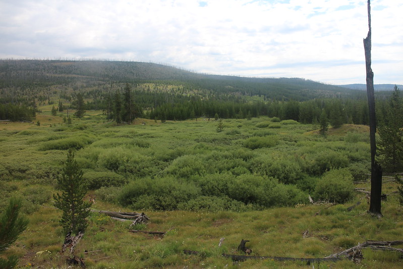
Meadows on the West side of Two Ocean Plateau
Back at camp
Day 11 - Campsite 6A3 to campsite 5E3 (5.8 miles) - The highlight of today’s paddle was the Yellowstone River Delta. We found out that the delta has many shallow spots and had to be careful not to run aground while passing by. Once we arrived at our campsite, we did a couple mile hike north on the Nine Mile Trail that runs along the eastern side of Yellowstone Lake.

Day 11 overview
Two Ocean Plateau

Paddling by the Trail Creek Patrol Cabin and outbuildings
The Yellowstone River Delta

The Yellowstone River Delta

Heading towards Langford Cairn

Arriving at campsite 5E3

View of the east side of the Promontory across the Southeast Arm
Nine Mile Trail
View to the south from our campsite with the evening sun

Sun rays beaming through the clouds

Sun rays beaming through the clouds
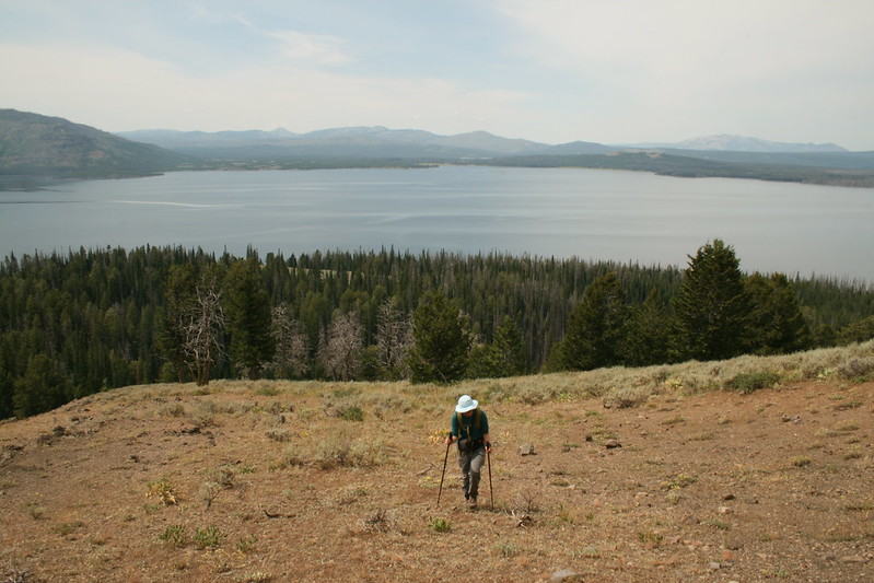
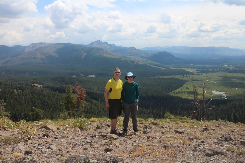
Day 12 - Day Hike to Lainford Cairn (5.5 miles RT) - The hike up Laingford Cairn starts out on the Nine Mile Trail and then is off-trail to the top. Once we exited the trees along the lake, we made our way up the ridge. There was one nasty, steep ravine we had to make our way through on the way up, so when it was time to come back down we chose a different route to avoid that ravine.
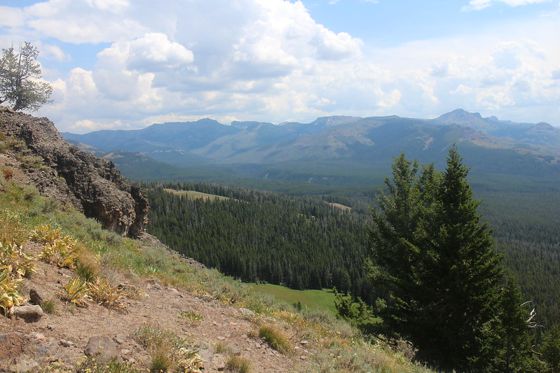
The views from the top were tremendous. To the south you can see the Yellowstone River Delta and down into the Thorofare. To the east, a wonderful view up the Beaverdam Creek Drainage with views of Mount Shurz, Mount Humphreys and Eagle Peak. To the west, we could almost make out our entire route, though our starting point at Grant Village on West Thumb was out of view. This hike is well worth your time IMO if ever you are in the area.

Day 12 overview

View towards the lake from Nine Mile Trail

Bushwhacking again towards Langford Cairn
Katie, making her way up the hill
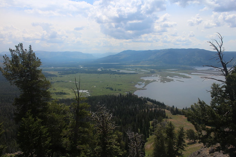
The Yellowstone River Delta and Two Ocean Plateau

View south into the Thorofare on a hazy day
View up the Beaverdam Creek Drainage
On top of Langford Cairn
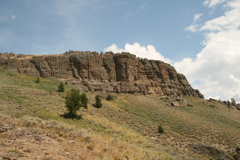
The rock face of Langford Cairn
Nine Mile Trail on our way back to camp
Dinner time
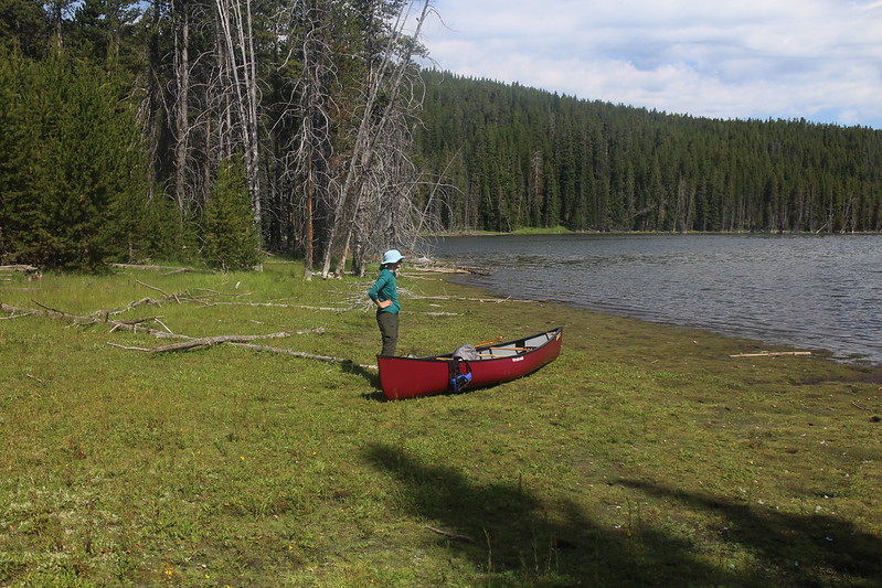
Day 13 - Campsite 5E3 to campsite 5E6 (4.5 miles) - An easy day today, after paddling to camp, we hiked south to Columbine Creek. Other than that, it was a take it easy day for the rest of the evening.

Day 13 overview

Katie found a PAKO's floating in the lake before shoving off in the morning

Tent site at campsite 5E6
View to the south along the shoreline from campsite 5E6

View of The Promontory from campsite 5E6

A short day hike to Columbine Creek

Nine Mile Trail
Storm clouds moving in
Day 14 - Campsite 5E6 to Sedge Bay (9.8 miles) - We went to bed with a calm lake and starry skies, but I woke up to lightning flashes around 3:00 am. I got out of the tent to check on the situation and saw that we still had stars above us, but to the northeast thunderstorms were raging and of course the lake was no longer calm at this point. I went back to bed and woke up to Katie’s alarm at 5:20. It was raining. We broke down the tent, packed our gear and ate our breakfast in the rain. Once we started loading the canoe, the rain stopped but the lake was still a bit choppy. We shoved off a little after seven and as we approached Signal Point things got hairy. The shoreline along Signal Point is cliffy and there is no place to land your canoe, and the waves bash against the bottom of the cliffs with tremendous force. The lake was getting extremely choppy and a few small whitecaps were appearing and I’m thinking to myself “Shit!” This is what I refer to as “Butt Pucker Moments.” We were able to ride it out with some powerful paddling, but it was mentally and physically taxing. Once we got beyond Park Point, to the north of Signal Point, the lake calmed down and it was smooth sailing all the way to Sedge Bay.

Day 14 overview

Heading towards Signal Point
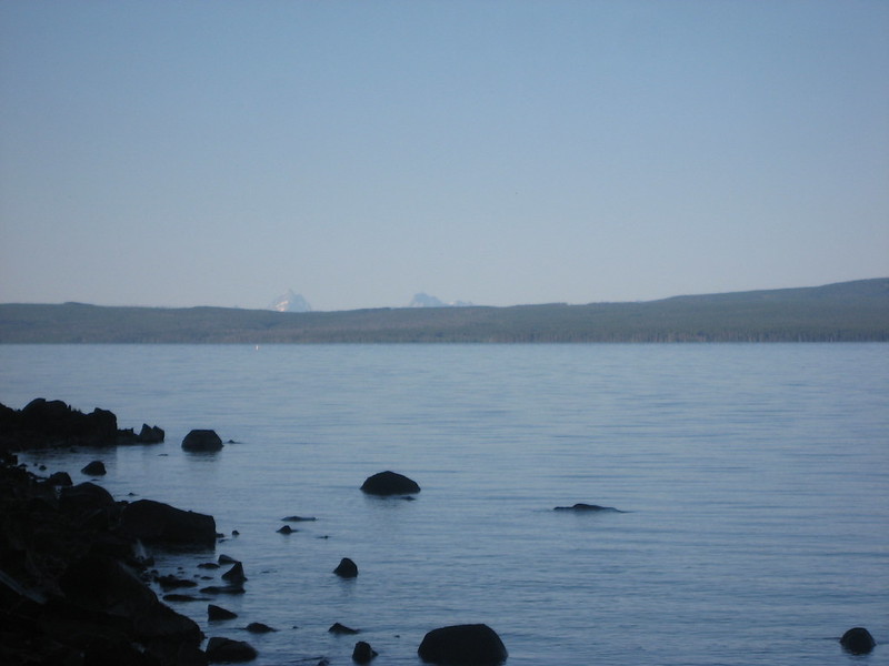
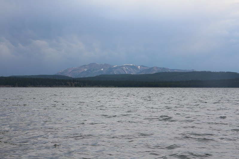
The Tetons are barely visible across the lake
One last break before leaving the backcountry

View across the lake

Made it to the finish line! On shore at Sedge Bay
Well that about sums it up. We did see other people on three of the fourteen days that we were on the lake. On day five, we passed five kayakers doing our trip in reverse. On day nine, we saw the ranger at Trail Creek Patrol Cabin and on day thirteen, five backpackers stopped by our campsite to refill their water bottles. So not too bad in the people department. As for wildlife, here is a list of what we encountered over the two weeks:
Bald Eagles – 28
Golden Eagles – 4
Hawks – 4
Falcons - 1
Loons – 7
Pelicans – 78
Ducks – uncountable multitudes
Sandhill Cranes – 6 (heard many more)
Osprey – 2
Grouse – 12
Blue Heron – 2
Canadian Geese - uncountable multitudes
Deer – 21
Elk – 2 (heard many more – one barked at our tent on night 5)
Grizzly Bears – 1
Rabbits – 1
Weasels – 2
Otters – 1
Voles – 4
Mice – 2
Frogs – 6
Squirrels – a lot
Chipmunks - uncountable multitudes
Wolves – heard howling on two separate nights
I’m usually lucky enough to see or hear an owl when I’m in the backcountry in Yellowstone, but oddly that didn’t happen on our entire trip this time and no moose once again. The ranger had told us that there was a bull that tended to hang out in the marshy area along the Trail Creek Trail just southeast of the patrol cabin, but we paddled by that area on our way to 5E3 and didn’t see it. Of course, the Grizzly was the highlight of the trip for me, and I think my daughter as well.
Total mileage for the trip turned out to be 93 miles paddled and approximately 33 hiked.
Overall a great trip and highly recommended.
The End.

